

Author: Selby Cull
Institution: Hampshire College
Date: December 2002
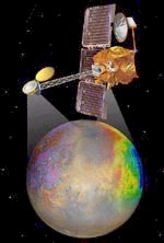
2001 Mars Odyssey, an orbiting spacecraft designed to determine the composition of the planet's surface, detect water and shallow buried ice, and study the radiation environment. Image courtesy of NASA Mars Missions
The southern hemisphere of Mars is a jagged, pummeled, and scarred terrain. Deep chasms gorge the crust, craters of all sizes pockmark the surface, towers of rock split the horizon where volcanoes lie dormant, and enormous channels cut across hundreds of miles of rocky terrain.
After billions of years of meteor impacts, volcanic eruptions, and flash floods, the surface of Mars's southern hemisphere is a testament to its violent history, and looks exactly as a planet with that history would be expected to look.
In contrast, the northern hemisphere of Mars is smooth, flat, and nearly untouched by the natural disasters that have marred the southern hemisphere. No great chasms have cut through the crust, few craters disrupt the landscape, and no channels cut its surface.
The solar system is a violent place for a planet. Meteors, comets, tidal interactions, and volcanism all gradually tear up a planet's surface until it is as battered as the moon. Earth is somewhat protected from these events by its thick atmosphere, and oceans and winds quickly remove evidence of impacts; however, other planets hold onto their impact craters for billions of years. To find, then, that more than one-third of a planet is smooth and without craters, is puzzling. The origin of one-third of Mars is still unexplained.

Topography of Mars. Data from Mars Orbiter Laser Altimeter (MOLA). MOLA is an instrument currently in orbit around Mars on the Mars Global Surveyor (MGS) spacecraft. Image courtesy of Jet Propulsion Laboratory, www.marsglobalsurveyor.com
Many models and theories have attempted to explain the odd form of the Martian northern lowlands. In the late 1980s, geologist Timothy Parker proposed one of the most controversial theories. Looking at the abrupt cliffs separating the cratered highlands from the low, flat northern plains, Parker thought he saw the shorelines of an ancient ocean. Ringing the northern third of the planet is a precarious line of cliffs, which may represent the edge of an ancient sea. Farther north, covering a much smaller area, is another such ring, where a small sea may have existed in more recent times.
Since the Martian ocean, if it ever existed, would have dried up more than two billion years ago - almost half of the planet's four-and-a-half-billion-year existence - deciphering the clues it would have left is difficult. Nevertheless, several lines of evidence point to the possibility of an ancient sea. In addition to the smooth, low plains and steep shorelines, numerous tall, narrow mesas are sprinkled about the plains-rather like islands on Earth-and the vast river networks crisscrossing the southern highlands end abruptly at the margin of the northern plains-like rivers flowing to the sea on Earth. The lack of large craters on the plains reveal their relatively young age - less than about two billion years old-and the severely degraded remains of ancient craters suggest that a prolonged eroding force was acting upon the plains. In addition, several studies have found sediments and sands deposited by water covering basin floors in the plains.
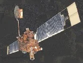
Mars Global Surveyor. The spacecraft's prime mission is to map Mars. The surveyor has studied the entire Martian surface, atmosphere, and interior, and has returned more data about the red planet than all other Mars missions combined. Image courtesy of NASA Mars Missions
The shorelines, river networks, island-like mesas, eroded craters, and water-deposited sediments all support the ocean hypothesis; however, they in no way prove it. Recently, contradictory evidence has emerged from Mars Global Surveyor data. The MGS, which began mapping Mars with the Mars Orbiter Camera and the Mars Orbiter Laser Altimeter (MOLA) in 1998, was intended to last for about two years. But the mission has been extended, and MGS will continue mapping Mars until its maneuvering propellant runs out. MOLA has been mapping elevations on the planet, and has found that the outer shoreline proposed by Parker varies in elevation by as much as five miles in places.
Since a level sea would have left a level shoreline, the MOLA data casts doubt on the idea that the outer contact is actually an ancient shoreline. However, it is possible that the shoreline was affected by later uplift via tectonic activity. MOLA data actually supports the hypothesis that the inner contact line - which may have represented a younger lake or smaller sea - is a shoreline, since the elevation of the line differs very little.
The presence of ancient oceans on Mars would have far-reaching implications in the hunt for evidence of life on the planet as well as for our understanding of planet formation and evolution. One of the first problems that would need to be solved is to determine where all the water went. Most likely, as Mars's core cooled, the surface of the planet did as well, and as the temperature dropped, the ocean froze over. The resulting sheet of ice would have eventually been covered by dust, dirt, and lava, hiding it from view. The thick layers of permafrost discovered just beneath Mars' surface support this idea, and it has been speculated that liquid water may still exist in underground rivers.
The Mars ocean debate is still unfolding. As new images and data pour in from Mars Global Surveyor and Mars Odyssey, new evidence emerges. If Mars did indeed have oceans, the possibility of finding evidence for ancient life on Mars increases. The discovery of shorelines and ancient lakebeds, then, may be an exciting step toward unearthing the origin of life and the existence of life elsewhere in the solar system.
Suggested Reading
Lucchitta, B., et al. "Sedimentary deposits in the northern lowland plains, Mars." Journal of Geophysical Research. v. 91, pg. E166-E174. 1986.
Malin and Edgett. "Oceans in the Martian Northern Lowlands." Geological Research Letters. v. 26, n. 19, pages 3049-3052. 1999.
McGill, G. "The Utopia Basin revisited: Regional slope and shorelines from MOLA profiles." Geophysical Research Letters. v. 28, n. 3, p. 411-414, February 1, 2001.
McGill and Hills. "Origin of giant Martian polygons." Journal of Geophysical Research. v. 97, pg. 2633-2647. 1992.
Parker, et al. "Mars: Implications for modification of the lowland/upland boundary." Icarus. v. 82. p. 111-145. 1989.
Tanaka and Banerdt. "The interior lowland plains unit of Mars." Lunar Planet. Sci. XXXI, Abstract #2041, Lunar and Planet. Inst. Houston (CD-ROM), 2000.
Thomson, K. and J. Head. "Utopia Basin, Mars: A new assessment using Mars Orbiter laser altimeter (MOLA) data." Lunar Planet. Sci. XXX, Abstract # 1894, Lunar and Planet. Inst., Houston (CD-ROM), 1999.